New in Forecast Bar 11.9.
Hour-by-hour Wildfire Smoke arrives with version 11.9, which is on its way to the App Store. The Wildfire Smoke layer and the PM2.5 forecast are in the app today.
Wildfire smoke in Forecast Bar, in short
- Smoke map
- The Wildfire Smoke layer shows near-surface smoke from NOAA's HRRR model, and clean air stays clear.
- Time range
- Wildfire Smoke plays hour by hour, from 12 hours ago to as much as 18 hours ahead.
- PM2.5 forecast
- NOAA's hourly PM2.5 guidance appears on the Air Quality data point, up to 48 hours ahead, as approximate AQI using the 2024 US EPA breakpoints.
- Fires
- The Fire Perimeters overlay draws reported fire boundaries. It is not an evacuation map.
- Alerts
- National Weather Service Air Quality Alerts arrive as weather alerts. Forecast Bar has no alert for an AQI level you set yourself.
- Coverage
- The Wildfire Smoke layer and the PM2.5 forecast cover the contiguous US.
- Platforms
- Wildfire Smoke is on iPhone, iPad and Mac. It is not on Apple TV.
- Plan
- Wildfire Smoke, Fire Perimeters and Air Quality are part of Gold on iPhone and iPad, and Pro on the Mac.
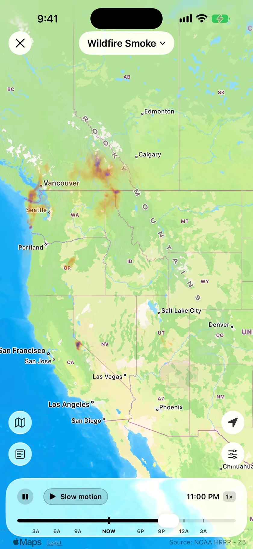
Follow the plume, hour by hour.
Wildfire Smoke draws what NOAA's HRRR model expects near the ground, rather than smoke high overhead. Play it forward to see which way the plume is heading, or scroll back to see where it came from.
- 12 hours back to as much as 18 hours ahead
- A legend from Low through Moderate and Heavy to Dense
- Clean air stays clear, so the map only marks smoke
- Turn on Fire Perimeters to see reported fire boundaries with it
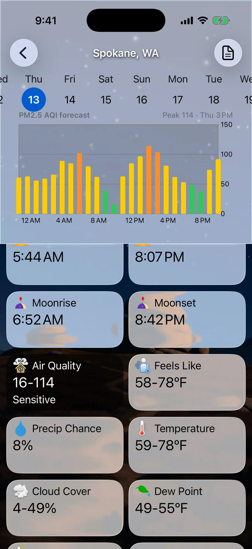
When will the air clear?
The Air Quality data point charts NOAA's hourly PM2.5 forecast, so you can pick the best hours for a run or decide when to close the windows. Each hour is shown as approximate AQI.
- Up to 48 hours of hourly values
- A peak label for the day you're viewing
- Move between days, or scrub the chart to compare hours
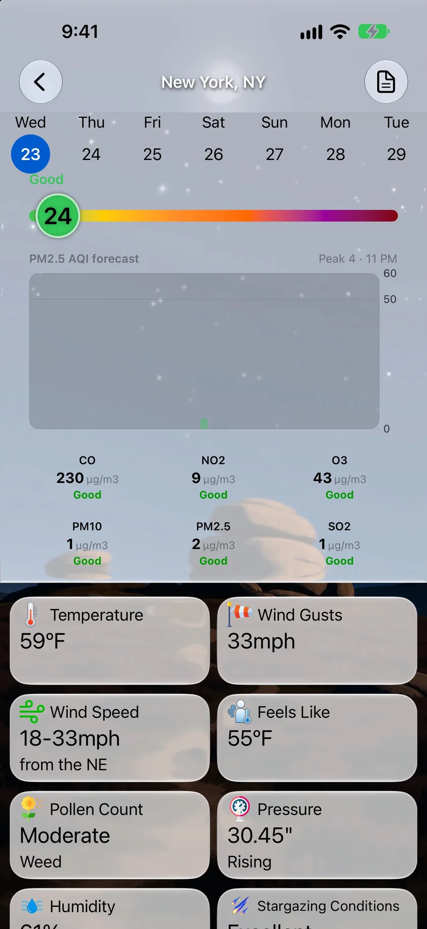
Check the reading before you head out.
Smoke forecasts can miss a sudden spike, so the current reading sits right above the forecast, with the numbers behind it. For the wider picture, see air quality and pollen.
- Current AQI with its category
- CO, NO2, O3, PM10, PM2.5 and SO2 readings
- National Weather Service Air Quality Alerts arrive as weather alerts
An honest note: this is a guide, not an evacuation tool.
Fire Perimeters shows reported fire boundaries, and they may be outdated or incomplete. They are not evacuation areas, so follow your local emergency services for those.
The Wildfire Smoke layer and the PM2.5 forecast cover the contiguous US, and Forecast Bar has no alert for an AQI level you set yourself. Smoke forecasts can miss sudden spikes, so check the current reading too.
Questions about wildfire smoke
Does Forecast Bar have a wildfire smoke map?
How far ahead does the smoke forecast go?
Can I see active fires on the map?
Will Forecast Bar warn me when the air gets bad?
Does the smoke map work outside the US?
How much does Forecast Bar cost?

Know when to close the windows.
Try Wildfire Smoke and the PM2.5 forecast free for 7 days with a new Gold subscription on iPhone or iPad.
Free to download; live weather requires a subscription. On iPhone and iPad, every subscription includes a 7-day free trial for new subscribers; Mac plans do not. Mac and iOS plans are separate; Apple TV is included with Forecast Bar Gold on iOS.
More from Forecast Bar
Air quality & pollen
AQI and pollen counts on your Home Screen, Lock Screen and watch face — plus an hourly PM2.5 forecast in the contiguous US.
Forecast maps
Temperature, feels like, dew point and wind maps that glide from hour to hour, on the best model for your region.
Severe weather alerts
NWS and Environment Canada warnings at the moment of issue, plus storm tracking that counts a storm down to your door.