New in Forecast Bar 11.9.
The maps on this page arrive with version 11.9, which is on its way to the App Store.
Forecast maps in Forecast Bar, in short
- Layers
- Forecast Bar's weather maps include Temperature, Feels Like, Dew Point, Wind Speed and Temperature Change.
- Time range
- Temperature, Feels Like, Dew Point and Wind Speed play from 12 hours ago to as much as 18 hours ahead.
- Temperature Change
- Temperature Change compares each hour with the same hour a day earlier, red where it's warmer and blue where it's colder, starting close to now.
- Playback
- Every map layer glides from frame to frame. On iPhone, iPad and Mac you can drag the timeline to any hour.
- Models
- The maps use HRRR in the US, HRDPS in Canada, ICON-EU in Europe and ECMWF everywhere else.
- Frame spacing
- Frames are hourly where a regional model covers your location, and every 3 hours under ECMWF.
- Platforms
- The forecast maps are on iPhone, iPad, Mac and Apple TV.
- Plan
- Forecast maps are part of Gold on iPhone, iPad and Apple TV, and Pro on the Mac.
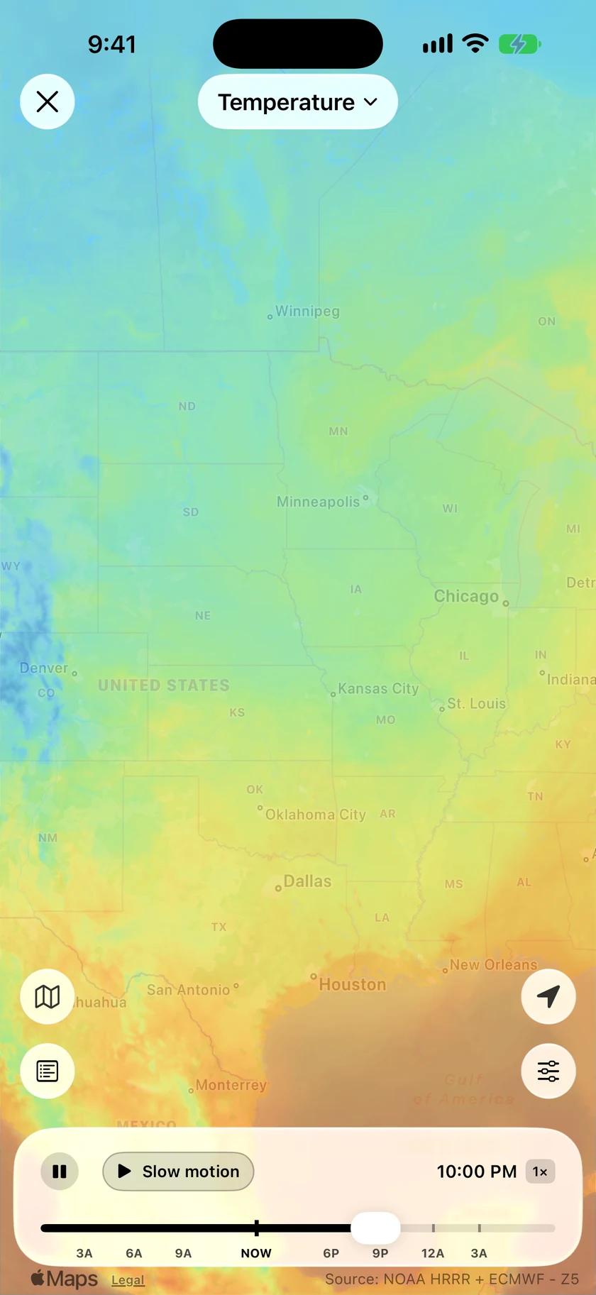
See how far the cold air gets by morning.
A forecast high tells you about one place. The map shows the whole front, how fast it's moving and which side of it you'll wake up on. Let it play or drag to any hour, and the colors glide from one hour to the next.
- Temperature, Feels Like and Dew Point, each with its own map
- 12 hours back to as much as 18 hours ahead
- Choose any of them as your Default Layer and the radar opens on it
- On iPhone and iPad, View on Map in Details opens the layer for that reading
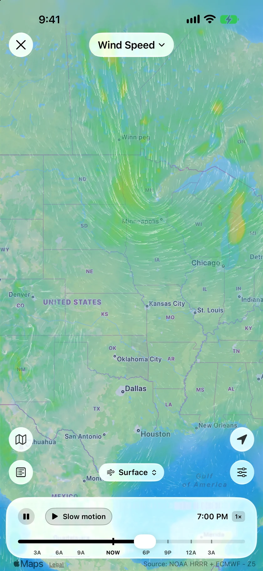
Wind you can see moving.
Wind Speed draws fine lines that flow with the wind, over colors that stay calm until it really blows. A storm's curl shows up right away. For hourly gusts, alerts and Apple Watch, see the wind forecast page.
- Animated flow lines over the wind colors
- The chip above the timeline picks the height
- Surface, then 5,000, 10,000, 18,000, 30,000 and 34,000 ft
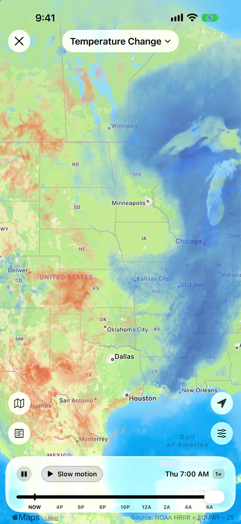
Is it colder than yesterday?
It's what most of us want to know before picking a jacket. Temperature Change compares each hour with the same hour the day before, so a front shows up as a clear edge between red and blue.
- Red is warmer than 24 hours earlier, blue is colder
- Starts close to now and runs as much as 18 hours ahead
- Uses the same regional models as the other maps
An honest note: detail depends on where you are.
HRRR, HRDPS and ICON-EU are regional models, so the US, Canada and most of Europe get hourly frames and the finest detail. Everywhere else uses ECMWF, a global model, with frames every 3 hours. Forecast Bar picks the model from your location, and past a regional model's edge the map fades into the global one.
The timeline is built from the latest model run, so in the US it often ends a couple of hours short of 18 hours ahead. These are forecasts, and the far end of the timeline is less certain than the near end.
Questions about forecast maps
Does Forecast Bar have temperature and wind maps?
How far ahead do the weather maps go?
Which forecast model do the maps use?
How are forecast maps different from radar?
Can I use the maps on Mac and Apple TV?
Is there a UV map?
How much does Forecast Bar cost?

See tomorrow morning on the map.
Try forecast maps free for 7 days with a new Gold subscription on iPhone or iPad.
Free to download; live weather requires a subscription. On iPhone and iPad, every subscription includes a 7-day free trial for new subscribers; Mac plans do not. Mac and iOS plans are separate; Apple TV is included with Forecast Bar Gold on iOS.
More from Forecast Bar
Weather radar for iPhone & iPad
Animated radar with future radar, live lightning, satellite, and warning polygons on the map.
Wind forecast
Wind speed, gusts and direction by the hour, an animated wind map, gust alerts and a Wind screen on Apple Watch.
Satellite weather
Forecast Bar's own GOES imagery, with clouds that drift smoothly, visible light by day and a Storm Tops style.