New in Forecast Bar 11.9.
The GOES imagery on this page arrives with version 11.9, which is on its way to the App Store.
Satellite in Forecast Bar, in short
- Source
- Forecast Bar builds its U.S. Satellite layer from NOAA's GOES-East and GOES-West satellites.
- Updates
- GOES scans arrive every 5 minutes, and the app moves the clouds along their own motion between scans.
- Styles
- Clouds draws white clouds over the map. Storm Tops colors the coldest, tallest storm clouds.
- Day and night
- By day the layer uses visible-light imagery. After dark it uses infrared, which works without sunlight.
- History
- The loop plays the last 2 hours of scans, or 6 hours at 15-minute steps on the 18 Hour timeline.
- Coverage
- U.S. Satellite covers the contiguous US, nearby parts of Canada and Mexico, and the surrounding oceans. Alaska is outside it.
- Platforms
- U.S. Satellite is on iPhone, iPad, Mac and Apple TV.
- Plan
- U.S. Satellite is part of Gold on iPhone, iPad and Apple TV, and Pro on the Mac.
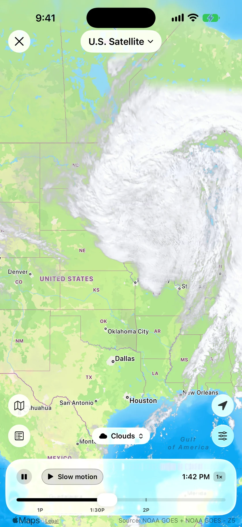
Clouds that move like clouds.
Satellite loops usually jump from one picture to the next. Forecast Bar measures how the clouds moved between scans and carries them along that motion, so a storm system turns on the map instead of flickering.
- New GOES scans every 5 minutes
- GOES-East and GOES-West blended into one picture
- Clear ground stays clear, using NOAA's cloud mask
- Visible light by day, infrared after dark
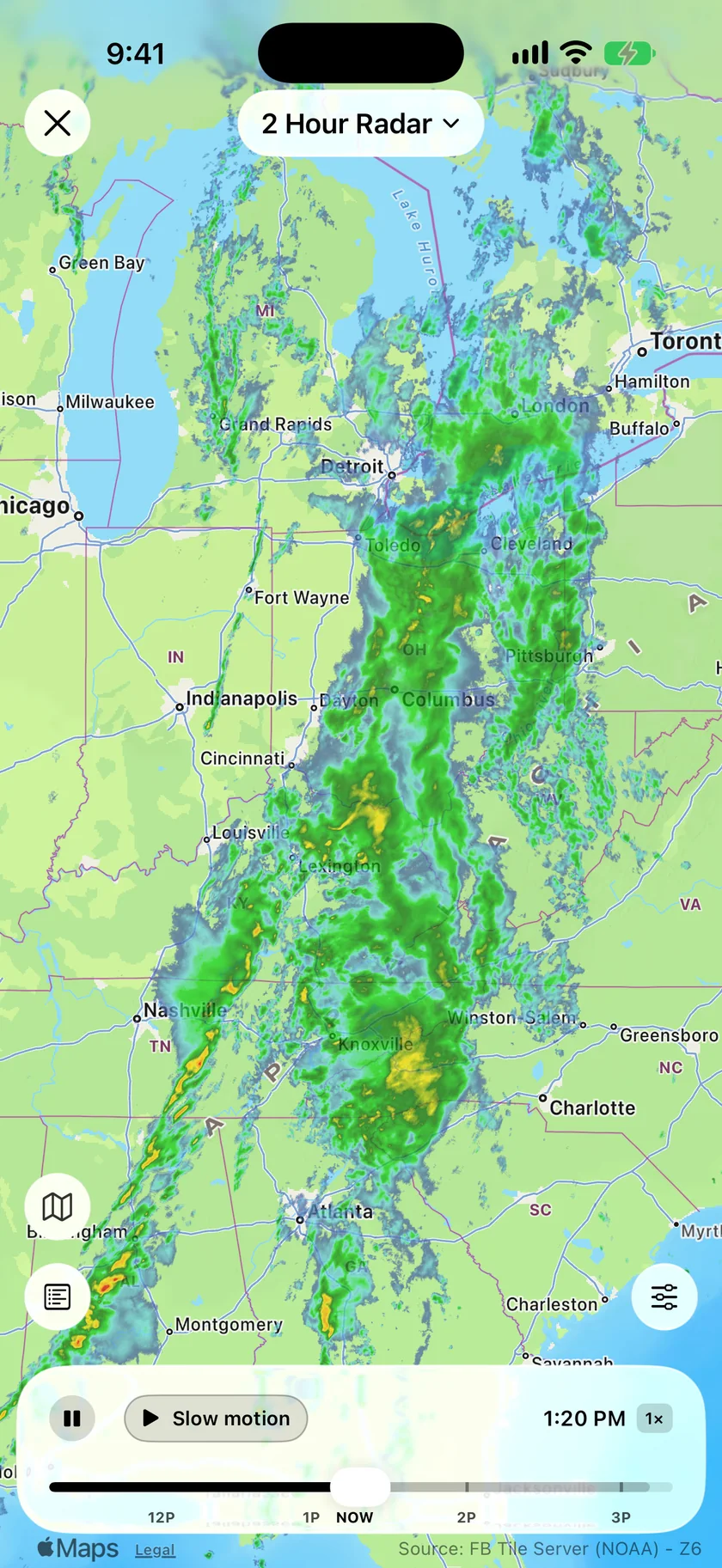
One shows the cloud, the other shows the rain.
A satellite picture tells you where the sky is overcast and where it's breaking up. It can't tell you whether anything is reaching the ground, so flip to radar in Radar Layers to see the rain under those clouds.
- Storm Tops colors the coldest, tallest clouds, where storms are building highest
- Clouds is the plain view, white over the map
- The chip above the legend switches between them
- 2 Hour Radar is included with Silver on iPhone and iPad, and Plus on the Mac
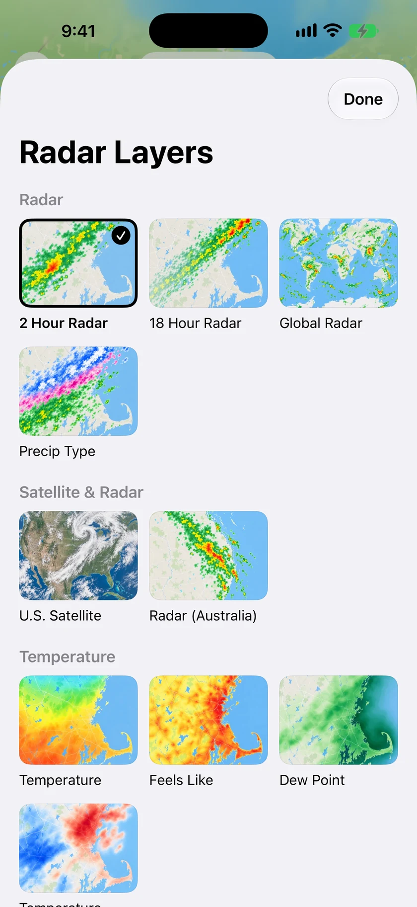
Pick it by its picture.
Radar Layers shows every layer as a small picture of what it draws, with U.S. Satellite in the Satellite & Radar group. If you check the clouds first thing, make it your Default Layer in Radar settings and the radar opens straight onto it.
- Every layer shown as a picture
- Default Layer opens the radar on satellite
- Where it covers you, it stands in for the regular Satellite layer
An honest note: satellite shows what has already happened.
U.S. Satellite has no forecast frames. The loop ends on the latest scan, so for what's coming, use radar or the forecast maps.
Coverage follows the GOES satellites' view. Outside it, including in Alaska, Radar Layers offers the regular Satellite layer instead, and Europe has its own IR and visible satellite layers.
Questions about satellite
Does Forecast Bar have satellite imagery?
How often does the satellite image update?
What is Storm Tops?
Does satellite work at night?
Does Forecast Bar show satellite forecasts?
Does U.S. Satellite work outside the US?
How much does Forecast Bar cost?

See the whole storm from above.
Try U.S. Satellite free for 7 days with a new Gold subscription on iPhone or iPad.
Free to download; live weather requires a subscription. On iPhone and iPad, every subscription includes a 7-day free trial for new subscribers; Mac plans do not. Mac and iOS plans are separate; Apple TV is included with Forecast Bar Gold on iOS.
More from Forecast Bar
Forecast maps
Temperature, feels like, dew point and wind maps that glide from hour to hour, on the best model for your region.
Weather radar for iPhone & iPad
Animated radar with future radar, live lightning, satellite, and warning polygons on the map.
Severe weather alerts
NWS and Environment Canada warnings at the moment of issue, plus storm tracking that counts a storm down to your door.