Road layers in Forecast Bar, in short
- Cameras
- As of November 2026, Forecast Bar shows road cameras from transportation agencies in Alabama, Alaska, Arizona, California, Delaware, Georgia, Idaho, Iowa, Louisiana, Maryland, Missouri, Nevada, North Carolina, Ohio, Utah and Washington.
- Camera views
- Cameras appear as live video or periodic snapshots, depending on the agency, and nearby views can play together in a grid.
- Road conditions
- The Snow, Ice & Road Conditions overlay shows conditions as transportation agencies report them. It reaches fewer states than the cameras do, and some report only in winter.
- Traffic
- Road closures, traffic incidents, work zones and message signs are separate overlays, each with its own switch.
- Temperatures
- The Road & Air Temperatures overlay shows measured road-surface and air temperatures where a station reports them.
- Travel View
- The Travel radar View turns on traffic incidents, work zones, road conditions and cameras in one tap, over whatever map layer you're on.
- Coverage
- Road data comes from US state agencies, so it varies by state, and the road layers cover the United States only.
- Plan
- Road layers need Forecast Bar Gold on iPhone and iPad, and Pro on the Mac.
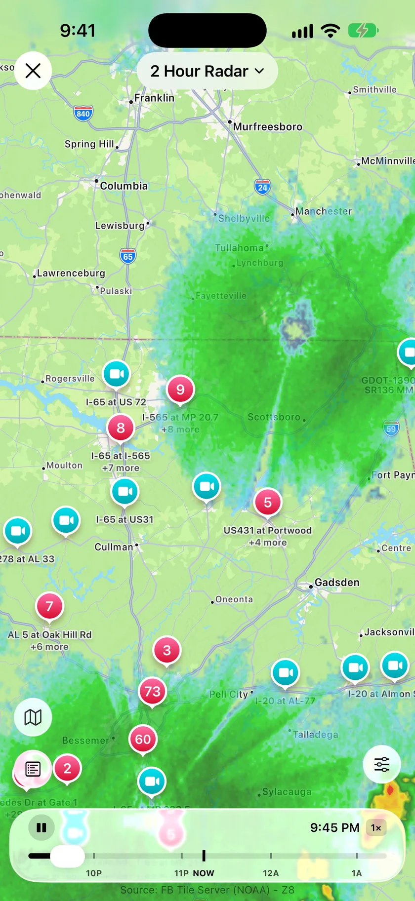
Cameras and radar on one map.
Turn on Road Cameras and the agency's cameras line up along the highways with the radar still playing underneath. When a band of rain is about to cross I-65, tap the camera there and look. Pick the overlays you want one at a time, or use the Travel View and have the ones a drive usually calls for set in a single tap.
- Travel View: Traffic Incidents, Work Zones, Snow, Ice & Road Conditions and Road Cameras
- Camera pins gather into numbered clusters as you zoom out
- Road Closures and Message Signs have their own tiles in Overlays
- Save your own View with the layers you always want
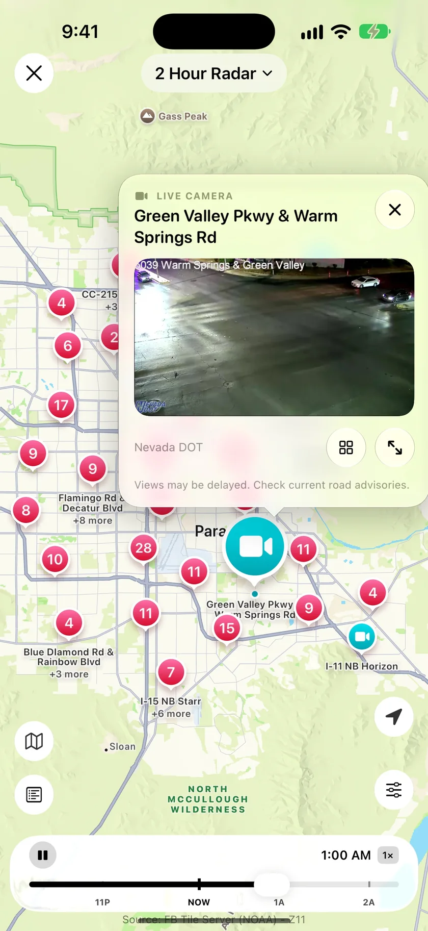
A camera view that stays over the radar.
Tap a pin and the view opens in a card above the map, labelled with the agency that runs it. Where cameras cluster, the card plays several nearby views at once in a grid and keeps yours in the middle, so you can scan a stretch of road without opening and closing cards.
- Live video or periodic snapshots, depending on the agency
- Expand a view to full screen, with Fill or Fit
- A camera that's offline says so
- The card reminds you views may be delayed
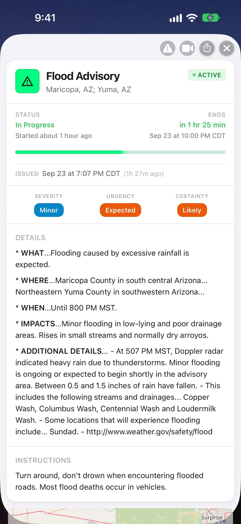
From the alert to the road it covers.
When an alert comes with a mapped area, two extra buttons sit at the top of its detail screen. One opens the radar at that spot with road conditions on, and the other with cameras on, so a flood advisory can take you straight to the roads inside it.
- View road conditions near an alert
- View cameras near an alert
- Weather Road Alerts show agency-reported snow, ice and flooding
- Road & Air Temperatures sit in compact pins that group as you zoom out
An honest note: read these as reports, not guarantees.
Road information comes from state transportation agencies, so what you see depends on where you are. As of November 2026, the 16 camera states are the ones listed above, which leaves out big ones like Texas, Florida and New York. Some states have no agency road data in the app at all yet, including Texas, Michigan, Tennessee and Virginia. The road layers cover the United States only.
A road with no report isn't necessarily clear. It may be a road nobody is reporting on. A temperature on its own doesn't confirm ice, and a camera can be delayed or offline. Check current road advisories before you set out.
New in Forecast Bar 11.9.
Road conditions and cameras with live video come to Apple TV in version 11.9, which is on its way to the App Store. On the Mac, busy road layers show the most important markers first and reveal more as you zoom in.
Questions about road conditions and cameras
Which states have traffic cameras in Forecast Bar?
Are the traffic cameras live?
What does the Travel radar View turn on?
Does Forecast Bar show snow and ice on roads?
Can Forecast Bar tell me a road is safe to drive?
Do road layers work on iPad, Mac and Apple TV?
How much does Forecast Bar cost?

Check the road before you leave.
Try road cameras and conditions free for 7 days with a new Gold subscription on iPhone or iPad.
Free to download; live weather requires a subscription. On iPhone and iPad, every subscription includes a 7-day free trial for new subscribers; Mac plans do not. Mac and iOS plans are separate; Apple TV is included with Forecast Bar Gold on iOS.
More from Forecast Bar
Trip weather for iPhone & iPad
The forecast for trips on your calendar or added by hand, right on your main screen.
Weather radar for iPhone & iPad
Animated radar with future radar, live lightning, satellite, and warning polygons on the map.
Snow & winter weather
Rain, snow, ice and freezing rain on Smooth Radar, snow totals up to three days ahead, and road conditions in one tap.